We’ve all been there. The forecast promises a classic 20-knot Nor’easter, so you cancel your plans, pack the car, and drive an hour to the coast, only to find it barely blowing 10 knots. Or worse, you stay home looking at a marginal forecast, only to see social media light up with photos of your mates scoring an epic, un-forecasted session.
The truth is, wind forecasting is a complex science, but you don’t need a degree in meteorology to dramatically improve your strike rate. The key is understanding what the models are actually telling you and, more importantly, what they’re leaving out.
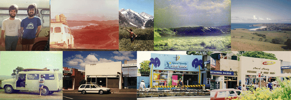
This guide is for NSW Wave Sailing Association members who want to stop guessing and start scoring. We’ll break down how to interpret forecasts more accurately, avoid those wasted trips, and learn how to spot the hidden gems—the days that will be much better than the big models suggest.
How Forecasts Are Made — The Basics You Need to Know
Every wind forecast you see in an app starts its life as a set of complex equations. Supercomputers solve fluid-dynamics and thermodynamic formulas on a massive 3D grid that covers the globe.
- Data Inputs: The process begins with a huge amount of data from surface weather stations, weather balloons (radiosondes), ships, buoys, aircraft, radar, and satellites. This creates a “snapshot” of the current state of the atmosphere.
- Models and Grids: The model then projects this state forward in time. The detail it can capture depends on its resolution, or the spacing of its grid points.
- Global Models (e.g., GFS, ECMWF): These have large grid spacing, often tens of kilometres apart. They are excellent for forecasting synoptic-scale systems—the big high and low-pressure systems, fronts, and multi-day trends that drive our weather.
- Mesoscale / Regional Models (e.g., ACCESS-R, WRF): These have a much finer grid, typically from 1 km to 12 km. They cover a smaller area but can simulate local weather phenomena like sea breezes, terrain-channelling, and thunderstorms with far greater accuracy.
Crucially, the apps and websites we use (like Windy, Windfinder, WindGuru) are simply user-friendly interfaces for this model output. They don’t create predictions themselves; they display the model’s data fields, like wind speed at 10 m and gusts.
Which Models to Use and When
Using the right tool for the job is critical.
- Long-Range Planning (3+ days): Stick to the global models like ECMWF (often considered the most accurate) and GFS. Use them to see if a strong pressure system or front is heading our way. Is a big southerly buster likely by the weekend? Is a high-pressure system going to set up, favouring Nor’easters?
- Short-Range & Day-Of (0–48 hours): Now is the time to prioritise the high-resolution models. Look for ACCESS-R (the Bureau of Meteorology’s regional model) or the “Superforecast,” “High-Res,” or AROME/ICON-D2 options in your favourite app. These are the models that will attempt to capture the local effects that make or break a session.
- Pro Tip: Always use more than one model. If ECMWF, GFS, and a high-res model all agree on timing and strength, your confidence should be high. If they disagree, it signals uncertainty, and you’ll need to rely more on local observations.
Finally, pay attention to the variable you’re looking at. The model’s mean wind speed at 10 m is one thing, but for wave sailing, the gusts are what really matter. Always check the gust forecast; it dictates your safety margin and sail choice.
The Secret Sauce: Key Local Wind Systems for NSW
This is where local knowledge turns a good forecast into a great one. The big models might show a light 8-knot breeze, but local topography and heating can easily double that. Here are the effects you need to look for in NSW.
1. The Sea Breeze (Onshore Breeze)
- Mechanism: On a sunny day, the land heats up faster than the sea. This creates an area of lower pressure over the land, and the cooler, denser air from the sea flows inland to fill the void. This is the classic summer Nor’easter or NE sea breeze for much of the NSW coast.
- Forecast Clues: Look for a weak synoptic gradient (light winds on the GFS/ECMWF model) combined with a forecast for a warm, sunny day. The high-resolution models will often show a distinct increase in onshore wind speed starting in the late morning and peaking mid-to-late afternoon.
- Practical Tip: If the global model shows 5-10 knots onshore but the day is forecast to be sunny and warm, start looking at the high-res models for an afternoon sea breeze to kick in. Cloud cover is the enemy of the sea breeze—a cloudy day will suppress it significantly.
2. Gap Winds / Channelled Winds
- Mechanism: When wind is forced through a narrow gap—like between two headlands, through a river mouth, or down a coastal valley—it must accelerate. This is the Venturi effect.
- Forecast Clues: Look at the wind vectors or streamlines on a high-resolution model. If they are aligned with a known gap and show a clear increase in speed through that specific area, you’ve found a gap wind. Even a moderate synoptic gradient can produce strong, localised winds in these places.
- Practical Tip: Spots with significant topography like parts of the South Coast, the entrance to Broken Bay, or the Hunter Valley can experience much stronger winds than the broader forecast suggests if the wind direction aligns with the terrain.
3. Cape and Headland Acceleration
- Mechanism: Similar to gap winds, wind flowing around a prominent cape or headland must speed up as it travels a longer path. This can create a zone of significantly stronger wind just downwind of the headland.
- Forecast Clues: High-resolution models will show streamlines bending around the cape, with the wind vectors lengthening (indicating higher speed) on the downwind side.
- Practical Tip: When sailing near a large headland, expect the wind to be gustier and stronger than it is further out in the bay.
A Practical Forecast-Reading Workflow
Put it all together with this step-by-step process before you head out.
- Start with the Synoptic Picture (3 days out): Use ECMWF or GFS on Windy or a similar app. Is a strong southerly change coming? Is a high setting up in the Tasman Sea? This tells you whether to expect widespread winds (strong gradient) or if local effects will dominate (weak gradient).
- Drill Down with High-Resolution Models (48 hours out): Now, compare the high-res runs (e.g., Windfinder “Superforecast,” ACCESS-R). Look at the hourly breakdown. Do they show an afternoon sea breeze? Is there a sharp increase in wind around a headland?
- Check Recent Observations: This is your reality check. Before you leave, look at:
- Buoy and Coastal Station Reports: The BOM website provides real-time data from coastal stations. Is the wind trending in the direction the model predicted?
- Airport METARs: Reports from airports like Sydney Airport (YSSY) or Williamtown (YWLM) give you precise, recent wind speed and direction.
- Webcams: Nothing beats seeing the water surface with your own eyes.
- Consider Diurnal Effects & Timing: If the models show a light onshore gradient and it’s a sunny day, factor in a sea-breeze. Know the typical timing for your local spot—some places fire up at 1 pm, others not until 3 pm.
- Make a Confidence Call:
- High Confidence: All models agree, the synoptic gradient is strong, and current observations support the forecast. Go for it.
- Medium Confidence: The synoptic gradient is weak, but high-res models show a local peak, and it’s a sunny day. Plan for an afternoon session and keep an eye on the live data.
- Low Confidence: The models disagree, observations are patchy, and cloud cover is uncertain. It might be a day to wait for more concrete signs before committing.
Examples: Interpreting Forecasts for NSW Spots
- Port Stephens / Stockton: A classic sea-breeze location. In summer, with a light synoptic gradient, look for a building NE’er through the afternoon. The heads can channel and accelerate the flow significantly.
- Broken Bay / Pittwater: A playground of terrain effects. Flow aligning with the main channel between Barrenjoey and Box Head can accelerate dramatically. The afternoon sea breeze is often relentless in summer once it gets going.
- Botany Bay / Sydney: The summer NE sea breeze is king. It often establishes itself very reliably in the early afternoon. Watch for acceleration across the bay and gustiness near the headlands at Kurnell and La Perouse.
- Jervis Bay / St Georges Basin: The basin’s geometry can create its own thermal effects. Look for sea breezes wrapping around the headlands and accelerating into the bay. Cloud cover is a critical factor here.
- Bermagui / South Coast: Gap and cape effects are very important along this rugged coastline. A southerly gradient can be significantly amplified by local topography. On lighter wind days, local heating can still produce a rideable afternoon sea breeze.
Quick Decision Checklist Before You Go
| Question | Interpretation |
| Is the synoptic gradient strong and aligned with your spot’s exposure? | ✅ High confidence. Go. |
| Is the synoptic weak but high-res models show an afternoon peak + it’s sunny? | 🤔 Likely afternoon session. Check timing and obs. |
| Do the models disagree heavily or do observations not match the trend? | ⚠️ Be cautious. Monitor real-time data. |
| Are the forecast gusts significantly higher than the mean wind? | 💨 Rig down a size or be ready to. |
Your Digital Toolkit
- Windy: Unbeatable for visualising different models (ECMWF, GFS, etc.) and comparing them. The streamline animation is brilliant for spotting terrain effects.
- Windfinder: Excellent for its side-by-side “Forecast” (global model) and “Superforecast” (high-res model) comparison.
- Windguru: Provides a clear table layout that lets you compare multiple models (GFS, WRF, etc.) for the same spot at a glance.
- PredictWind: Also another great app often used be Yachties and boating enthusiasts
- Bureau of Meteorology (BOM): The source of truth for official synoptic charts, observations, radar, and marine forecasts in Australia. Learn to understand the METEYE for forecasting
- Local Observations: Find the webcams, buoys, and local harbour reports for your favourite spots and bookmark them.
The Ultimate Multiplier: Your Own Experience
The final piece of the puzzle is you. Keep a simple log of your sessions: what was the forecast, which models did you look at, what actually happened, and what time did it happen? After a season, you’ll build your own powerful rules of thumb. “At my spot, a GFS forecast of 12 knots NW in winter often means 20 knots by midday.”
Talk to the locals. The sailor who has been at that spot for 20 years knows which cloud formation signals the wind is about to die and which direction shift means it’s about to crank. This knowledge is priceless.
If your in Victoria Matteo who is NSW Waves sailing member does a great forecast on his youtube channel.
By combining the power of modern forecasting models with the subtleties of local knowledge, you’ll be well on your way to reading the wind like a pro—and scoring more great days on the water.